

The Piri Reis World Map, which was prepared by integrating the truths and wrongs of twenty maps, including the lost map of Christopher Columbus today, is a valuable historical document containing geography information about 16th-century Europe and Muslim sailors. The first world map drawn by the Ottoman admiral Piri Reis in 1513 is one of the oldest maps showing the American continent. The map, cut across the right, shows the west coast of Europe and Africa, and the east coast of South America. The original map drawn on gazelle skin with various colors, pictures, and writings is 90 x 65 cm in size. The original map is today in Topkapı Palace.
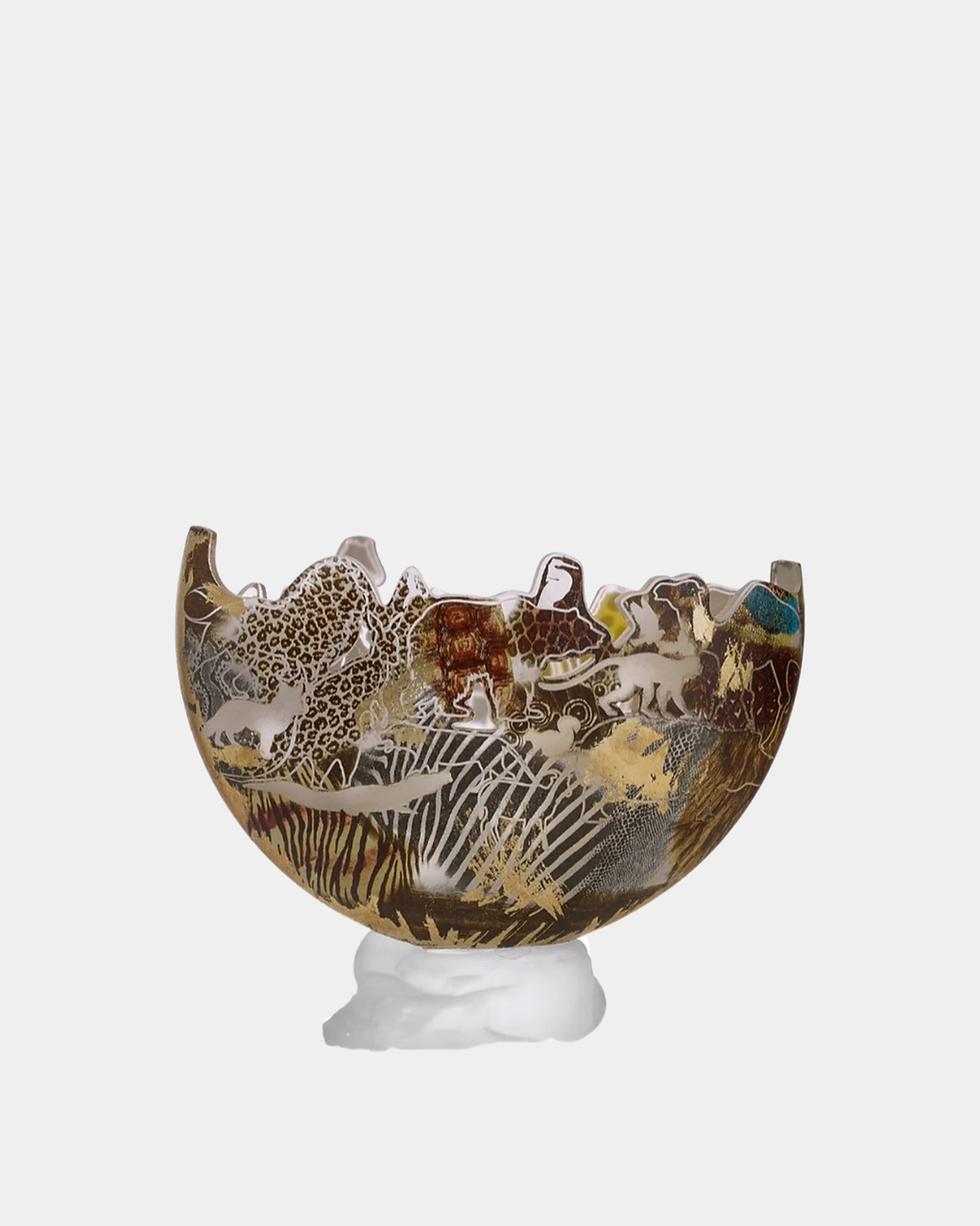
Map of Captain Piri Vase
Lenght: 18 cm
Width: 9.5 cm
Height: 25 cm100% handmade.
Cleaning Suggestion: Wipe with a dry cloth.
We want to ensure that you are completely satisfied with your purchase. In the event that you need to return an item, please carefully read and understand our Return & Refund Policy outlined below.
1. Returns:
We accept returns within 14 days of the original purchase date. To be eligible for a return, the item must be unused, undamaged, and in resellable condition, with all original packaging and tags intact. Please note that certain products, such as perishable goods or personalized items, are exempt from being returned unless they are faulty or damaged.
2. Return Process:
To initiate a return, please contact our customer support team within 14 days of receiving your order. We will provide you with instructions on how to proceed with the return. When contacting us, please provide your order number and a detailed explanation of the reason for the return.
3. Return Shipping:
The buyer is responsible for covering the shipping costs associated with returning the item. We recommend using a trackable shipping method to ensure the safe return of the product. Please note that we are not liable for any items lost or damaged during the return shipping process.
4. Refunds:
Once we receive the returned item and verify that it meets our return criteria, we will process the refund. The refund will be issued to the original payment method used for the purchase. Please allow for a reasonable processing time for the refund to be reflected in your account.
5. Non-Returnable Items:
Certain items are non-returnable unless they are faulty or damaged. These include but are not limited to perishable goods, personalized items, and items explicitly mentioned as non-returnable in the product description. Please review the product details carefully before making your purchase.
6. Exchanges:
We currently do not offer direct exchanges. If you wish to exchange an item, please follow the return process outlined above and place a new order for the desired item separately.
7. Damaged or Faulty Items:
If you receive a damaged or faulty item, please contact our customer support team immediately with photos and a detailed description of the issue. We will assess the situation and provide you with further instructions on how to proceed.
8. Changes to the Return & Refund Policy:
We reserve the right to update or modify our Return & Refund Policy at any time. Any changes will be effective immediately upon posting the updated policy on our website. We encourage you to review this policy periodically to stay informed about our practices.
If you have any further questions or require assistance regarding our Return & Refund Policy, please contact our customer support team. We are here to help and ensure your shopping experience is satisfactory.
We are committed to providing you with a seamless and efficient shipping experience. Please review the following shipping information to understand the process and policies associated with your order.
1. Processing Time:
Once you place an order for a home decor product, the processing time typically takes 1 week. During this period, our team carefully prepares your items for shipment, ensuring they are in pristine condition before they leave our facility.2. Tracking Your Order:
We understand the importance of keeping you informed about the status of your order. Therefore, we provide a convenient tracking feature on our website. Once your order has been dispatched, you will receive a tracking number via email. You can enter this tracking number on our website to monitor the progress of your shipment.3. Packaging:
To ensure the safety and protection of your order during transit, we package our furniture orders in sturdy plywood cargo crates. These crates are designed to withstand handling and transportation, minimizing the risk of damage to your items.4. Shipping Method:
For home decor orders, we primarily ship via air cargo if the size and weight of the product allow for it. This method ensures faster delivery times, getting your orders to you as soon as possible. In cases where the size or weight exceeds the limitations for air cargo, we carefully evaluate alternative shipping options to determine the fastest and most efficient way to deliver your order. Rest assured, we will communicate any changes or updates to you promptly.5. Worldwide Shipping:
We offer worldwide shipping.For selected countries, we are pleased to offer complimentary international shipping. Please note that free shipping eligibility may vary depending on the order value, product dimensions, and destination.
Once your order is placed, our team will contact you to share the most cost-effective and reliable shipping option available for your destination, along with the exact shipping cost (if applicable).
If you would like to receive a shipping quote prior to placing your order, please contact us — we will be pleased to assist you.
6. Customs Fees:
Please note that customs fees, import duties, taxes, or any other charges imposed by your country's customs authority are the responsibility of the buyer. These fees vary depending on your location and the value of your order. We recommend that you familiarize yourself with your country's customs regulations and potential fees before placing your order.We hope this shipping information provides you with a clear understanding of our processes and policies. If you have any further questions or require additional assistance, please do not hesitate to reach out to our customer support team. We are here to ensure your complete satisfaction with your online shopping experience.


